Water reserves in the Midwest are an endangered resource. XL performance will disrupt both our national food supply and the water for many cities.
High Plains Aquifer is dangerously depleted in large regions. This was the message by Michael Wines in the 2013 May 20 issue of the The New York Times. The water table in the mid US aquifer is being severely drawn down, certainly in Southwest Kansas (KS). This is variously called the Ogallala or High Plains aquifer if adjacent resources are combined.

Ben Stein
On 2013 Jun 1, actor/commentator Ben Stein was shown on Fox cable where he talked about Keystone XL protesters:
“Protests of this kind are a psychological issue, they’re not about an economic or political issue, they are about a psychological or mental disease or defect.”
Ok. Maybe I am mentally defective or diseased if I worry about Ben’s great-great grandchildren; he clearly does not. Note: Mr. Stein has parlayed his acting career into lucrative speechifying on right wing economics. As the son of Herbert Stein, a real economist, Ben is a good counter example to Lamarckian inheritance.
The strongest argument against the XL extension to the Keystone pipeline is the near-certainly of contamination of endangered US groundwater.
First, the groundwater issue. Then, why this matters for XL.
Groundwater Is A Key To Life.
 The NYT article describes a West Kansas well that produced 1600 USgal/minute (6000 L/min) when new in the 1960s but produced only 500 USgal/min in 1991 and was capped off. By 2012, its replacement pumped only 300 USgal/min. This is a major world-wide issue with which we will all become very familiar.
The USGS has a good place to learn about groundwater, good for grade school children and adults alike.
The locations of major groundwater pools are called aquifers. An aquifer is usually formed in a balance between the rate water enters (its infusion rate) versus the rate it leaves the underground “pool.” Estimates are that the High Plains aquifer formed about 2 million years ago and its volume was the balance between rainfall percolation from topsoil down to the water table and outflow to streams and rivers that flow through it. When people began farming there and living in cities and towns, this groundwater has been the source of life-giving water.

Fig 1: Aquifers in the US.
Fig 1 is from the the US government, and shows the major aquifers. Note that groundwater is all around us, aquifers are major storage locations. The central blue region is the Ogallala region.

Fig 2: Thickness of saturated water in the High Plains aquifer, 1997.
Fig 2 shows the thickness of water saturated soil in the High Plains (Ogallala) aquifer as of 1997. Source: Wikipedia Commons.
The most water is located in Nebraska with moderate amounts under western Kansas and Oklahoma. The NYT story was focused in the south western part of Kansas. I have not found a current mapping for the area, but we know that groundwater pumping, coupled with the extended drought in the region has reduced these saturated regions.
It would be nice to have more current maps to compare with, but this map required over 10,000 wells to be drilled to find the water table, then the bottom of the saturated region. Such things require funding and there has been no such U.S. interest since 2000 (Veep Cheney laughed at the panty-waists who worry about water availability. That was energy, actually, but his message went through Federal staff like a tornado through Oklahoma.)
All across the country, the reduction is severe. The USGS shows data that the water table in Chicago (located on the shore of Lake Michigan) dropped by 800 feet between 1864 and 1980.
Fig 3 , from the USGS site above, shows the depletion that has occurred in the US between from 1900 through 2008.

Fig 3: Depletion of groundwater in the US.
Fig 3 is color-coded in cubic kilometers of water volume (1 km3 same as 260 G USgal – 260 billion gallons). The dark red regions are areas of extreme depletion, and most of the regions are under attack. The Kansas region of the NYT story is in the overlap of several aquifers.
Fig 4 shows that reckless groundwater usage is the norm all around the world.

Fig 4: Change in world groundwater annual usage 1960 to 2000
This map, from the e360 project at Yale University, shows groundwater depletion for the single year, 2000. At that time: after Pakistan and China, the US has some of the most widespread over-usage in the world. Today, conditions are worse.
How Groundwater Relates To Pumping Dilbit
Canadian tar sands are currently being transported from the Athabasca tar sand fields Alberta to points in the U.S. via many different pipelines. The Keystone pipeline came on line in 2010 and was immediately proposed to be replaced or supplemented by the XL “upgrade.” See description in our earlier report.
The proposed XL runs parallel but West of the current Keystone line. It will use larger diameter pipe for greater cubic feet/min material transport even if pressures were kept at current levels. Drive pressure will be higher than Keystone for higher transport even in piping used were to be the same as Keystone. And the wall thickness will be reduced because that way, the larger pipe is cheaper.
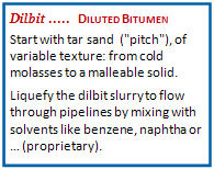 Rather than crude oil such as from traditional pumping rigs in Texas, it will carry a coarser, more aggressive fluid called dilbit. Keystone line has many issues (See our report). It certainly has a history of leaking its dilbit.
The new XL pipe must leak because it of the thinner wall / higher pressure / larger diameter thing. Even with its new route, XL passes through our endangered High Plains aquifer. Current estimates are that within a couple decades, plains cities may not be able draw water, and many farms in the American Bread Basket may close down for lack of water. Add XL leakage/seepage contamination of the groundwater and you are looking at a water resource disaster much sooner.
 Mr. Stein, this is not deranged thinking, this is a linear projection.
In 2010, Michigan suffered the Enbridge 6B pipe leak near the Kalamazoo River. That was small compared to what a similar duration high pressure line burst could do, but even today this has not been fully remediated, much of the dilbit that leaked out went into our ground water. Mayflower, Arkansas suffered from the Exxon Pegasus pipeline dilbit leak in March 2013. Both of these may be viewed as small potatoes by our grandchildren when they read their history books about how the fertile Midwest was lost.
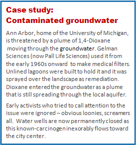 Contaminated groundwater is a real threat. The problem is how can you remediate chemicals that become widespread in the groundwater flow?
The case study here is from our own community. Activists who called alarm were treated as Ben Stein wants to treat national activists.
But the plume exists and it moves.
Aquifer contamination is important to any area that has that uses its water.
Dilbit is bitumen fluidized by ‘proprietary’ chemicals. XL leaks will seep this directly to the into the dwindling High Plains aquifer, making it unfit for drinking and the food raised on it potentially unfit for eating.
XL implementation will have little to do with curbing global warming, but has a lot to do with our water + food security.
Message to the White House: Kill the XL proposal.
……………………………….
Charles J. Armentrout, Ann Arbor
2013 June 7
Listed under Natural Resources … thread Natural Resources > KXL
Have a comment? Click on the title of this post, go to bottom, let us know.
Related posts: Click the INDEX button under the Banner picture
